featured work
ARCTIC COASTAL EROSION MAPPING
Arctic Coastal Erosion Mapping
Task: Large scale mapping of arctic community and its surroundings at risk of coastal erosion and flooding.
Challenge: Remote, hard to access locations. Fall in the arctic bringing inclement weather. Area too large and inaccessible to be completed by line-of-sight drone operations without extensive boat, ATV and helicopter support.
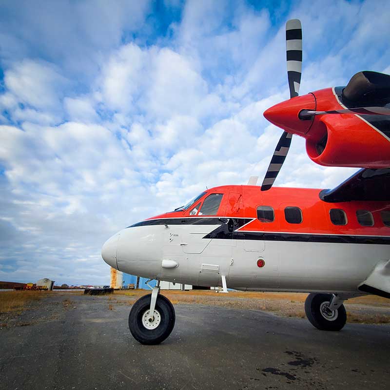
Solution: Work with local airline to equip a DHC-6 Twin Otter with airborne mapping equipment and antennas.
Methodology:
Step 1. Consult with local community members and stakeholders on the proposed operations and possible applications of data acquired.
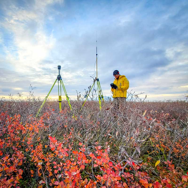
Step 2. Construct temporary and removable ground control points, sufficiently small to fit in a helicopter (considering both dimensions and weight) but sufficiently large to be visible in aerial images.
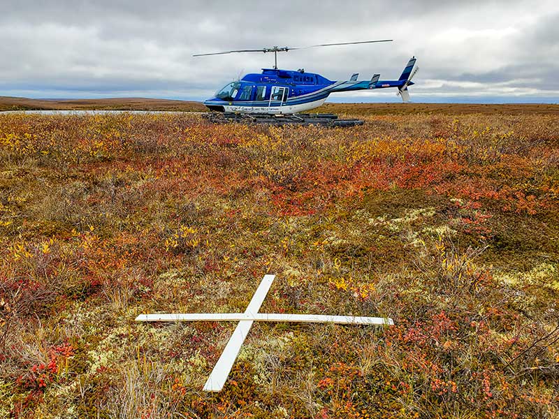
Step 3. Place and survey 20 ground control points by helicopter.
Step 4. Place and survey numerous check points by foot and vehicle.
Step 5. Equip DHC-6 Twin Otter with aerial mapping equipment and antennas.
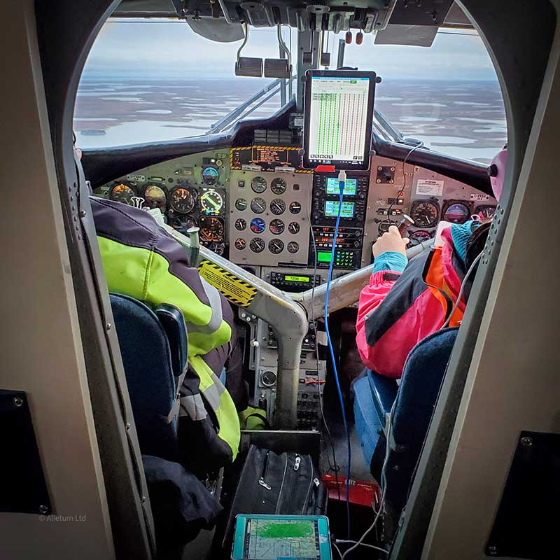
Step 6. Provide on-site training to Twin Otter pilots for on-board flight mission software.
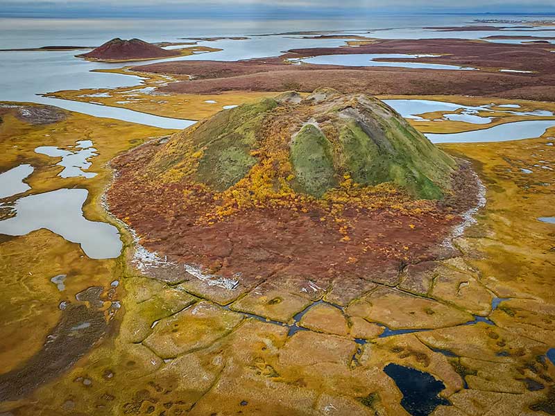
Step 7. Perform aerial mapping of 80 square kilometres of community, coastline and permafrost terrain using both RGB and near-infrared sensors.
Step 8. Access localized permafrost thaw slumps by helicopter, take oblique photos and video by drone.
Step 9. Collect removable ground control and check points.
Step 10. Process 4-band RGBI imagery and terrain data at 4 cm image resolution and less than 3 cm RMSE horizontal and vertical accuracy.
Step 11. Perform topographic and volumetric analysis on key areas of interest.